
Rinjani Trekking Map – Your Ultimate Guide to the Best Routes
Navigating the rugged terrain of Mount Rinjani requires a clear understanding of the routes, elevations, and key landmarks. Our detailed Rinjani trekking map will help you visualize the journey, from lush forests and crater rims to the summit and serene Segara Anak Lake.
Whether you’re trekking via Sembalun or Senaru, this map will guide you through every stage of your adventure. Get ready to explore the breathtaking landscapes of Indonesia’s second-highest volcano with confidence!
Check out the trekking map below and plan your perfect route!
2 Days 1 Night (2D1N) Crater Rim

2 Days 1 Night (2D1N) Summit

Mount Rinjani Second Summit Trek (3126m) 2 Days 1 Night

3 Days 2 Nights (3D2N) Crater Rim & Summit, Sembalun - Senaru

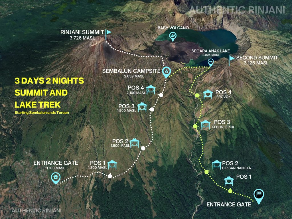
3 Days 2 Nights (3D2N) Crater Rim & Summit , Sembalun - Torean
4 Days 3 Nights (4D3N) Complete Rinjani Trek, Sembalun - Senaru
4 Days 3 Nights (4D3N) Complete Rinjani Trek, Sembalun - Torean